Tucson had been my poverty-era home, from January to September 2001, though I absolutely hated being there, between lack of economic opportunities and a very different mentality. Sure, the natural scenery was top-notch and the University of Arizona brought badly needed groove into town, but the fact remained that it was a Third World economy located in a far right tyranny state - and that is still the case in 2010, made even worse with the racist Governor Jan Brewer (though, honestly, I fully support profiling of socially conservative immigrants).
I had arrived after an overnight drive, checking into a Hampton Inn on Grant and I-10 early in the morning. Now that I am awake, I am heading for my first sight - Sabino Canyon, Tucson's best kept secret and a good place to go hiking.
As it is early March, Tucson was warm rather than hot. And by being in Tucson, 460 miles east of home, I am also ducking the consecutive weekends of rain that had been plaguing Los Angeles. Low 70s, low humidity, and partly cloudy day - perfect for hiking.
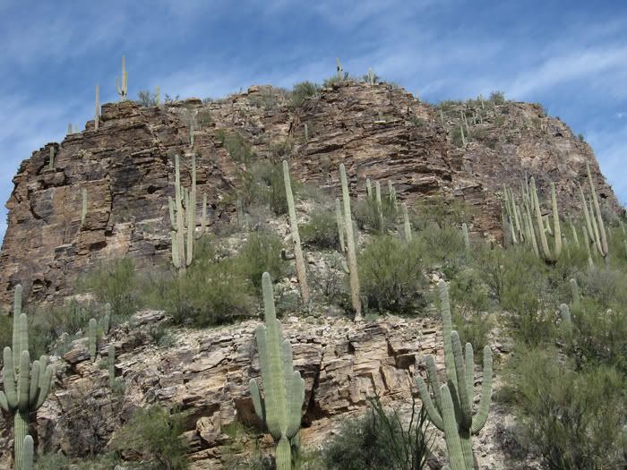
Arizona is famous for its saguaro cactus - and the saguaros tend to grow the best in the Tucson area, where it's comparatively higher, cooler and wetter than the rest of the desert portions of Arizona. Sabino Canyon is covered with saguaros as far as eyes can see. Quite a sight!
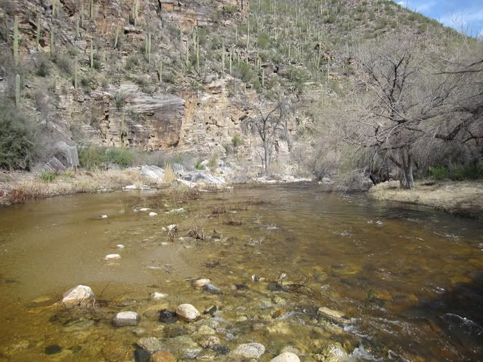
The word "sabino" in Spanish means rust. And while nobody remembers why the canyon got the name, a good guess is that it came from the color of the water; the water gets the rusty hue from the roots of oak trees that line the creek.
The immediate creek area gets plants that require lots of water, like oaks. Otherwise, this is all desert with severe conditions - extreme heat and thunderstorms in summer, and snow in winter. Yes, plenty of snow, as Mt. Lemmon, where the stream originates, stands quite high and is cold enough to host the southernmost ski resort in the US.
Sabino Canyon has a road that runs a few miles into the canyon. Built by the Civilian Conservation Corps during the Great Depression, the one-lane road crosses the creek several times before dead-ending; it had originally been meant to go all the way up to Mt. Lemmon, but the wider Catalina Highway fulfills that role instead. The road is served by visitor shuttles with driver narrations.
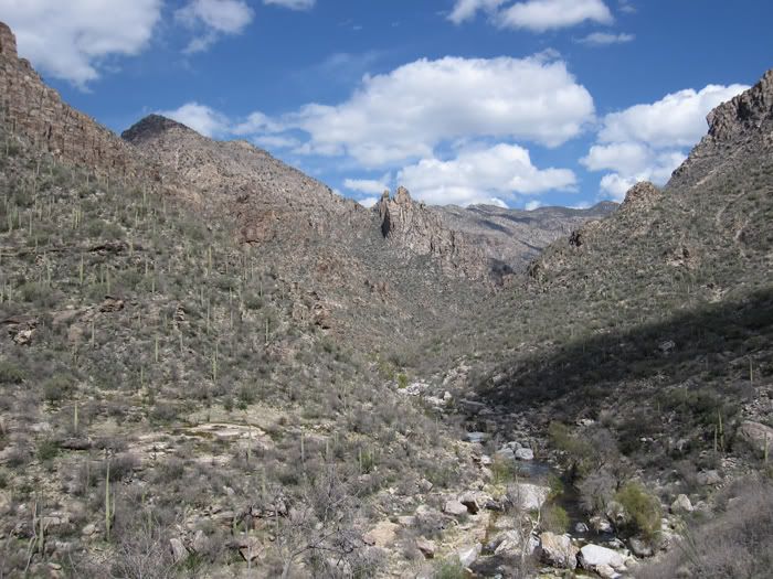
A look at Sabino Canyon. I have walked a bit from the dead-end of the road, and am facing the Mt. Lemmon direction. Quite a sight!
After Sabino Canyon, I had lunch, then drove west along Speedway Boulevard, the main east-west axis, toward the University of Arizona. I remembered driving the same stretch in a wrecked Ford Contour, unable to even buy gasoline, back in the day; now, I actually had some money in my purse, and my luxury Hyundai land yacht was all paid off, and it felt quite strange to drive the same streets of Tucson under much better circumstances. Though I do have to say, the run-down buildings and evidence of cut-rate economy remained very depressing in my mind, and those Eegee's fast food outlets, unique to Tucson, were as mysterious as ever.

I am now on Fourth Avenue just west of University of Arizona campus.
Antigone Books is the place to be if I want to buy feminist, or any other progressive/subversive, books. I can also buy related items, including bumper stickers and pendants. This would indeed be the place to buy a double-female symbol necklace, which I always wear.
When I called Tucson home, this was one of the few places I liked to hang out at.
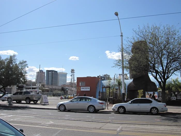
Thanks to its location next to the University, Fourth Avenue is the progressive/hippie/groovy part of Tucson, delivering a dose of personality to a city that badly needs it. I have to love that iron plate replica of the Easter Island statues.
Yes, that Hyundai Genesis is mine.
The three high-rise buildings in the back are in downtown, across the railroad tracks (Amtrak's Sunset Limited between Los Angeles and New Orleans uses those tracks), and are the only real highrises in Tucson. While Tucson does have over half a million people, it doesn't feel like it (and I don't mean this in a good way).
As seen in this photo, Fourth Avenue has a streetcar track, and Tucson does have a small fleet of vintage streetcars from foreign cities, similar to San Francisco's vintage fleet. They only run on special occasions, however.
Tucson does have an art museum in downtown, though it's not all that big. I'm cooling off there during the early afternoon hours before heading off for more hiking.
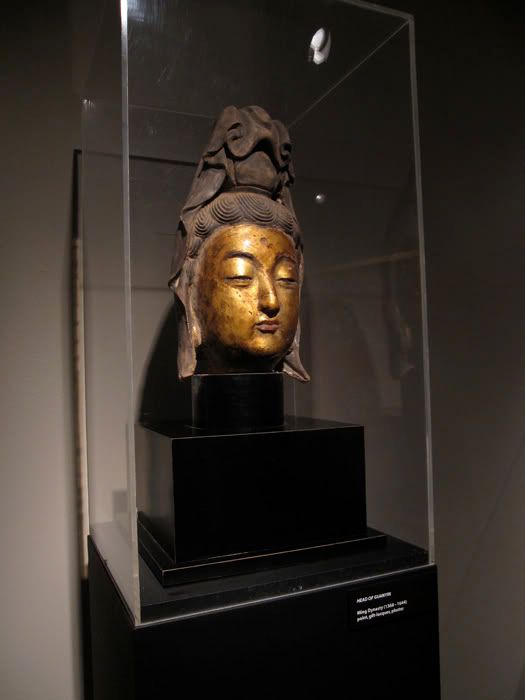
Due to proximity to Mexico's west coast, and the heavy Spanish influence in the local culture/population, the matron saint of choice in Tucson would most likely be Lady Guadalupe. But fortunately, the museum is hosting a limited-time exhibition of Chinese art, and here is a lacquer head of my transgender matron saint, Kwan Yin, dating from the Ming Dynasty, though the exhibition is centered around the much older Han.
The museum is close to Old Town with its super-narrow streets and adobe buildings resembling those of an old Mexican village. Also nearby is a hotel that used to be a Ramada Inn, where I used to attend weekly Mary Kay sales group meetings; the hotel is now a no-name independent property, and I'm so glad that I am no longer selling the Christian theocratic cosmetics. My entry into Mary Kay sales was itself a desperation measure due to extreme poverty.
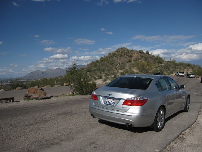
My next destination: Sentinel Hill, located just west of downtown across I-10. On its downtown-facing (eastern) slope, there is a large white letter A, standing for the University of Arizona, so the hill is also known as the A Mountain.
It's a good place to get bird's-eye views of Tucson, as well as the four out-of-this-world mountain ranges surrounding the city: Santa Catalina Mountains to the north (pictured to the left), Rincon Mountains to the east (snow-capped at this time), Santa Rita Mountains to the south, and Tucson Mountains to the west.
The human sprawl, compared to the stunning natural beauty, is very homely however. Though I could make out Davis-Monthan Air Force Base and its "Boneyard" that hosts retired military aircraft, as well as Tucson's only freeway interchange, where I-19 branches off from I-10 and heads south to connect to Mexican Highway 15.
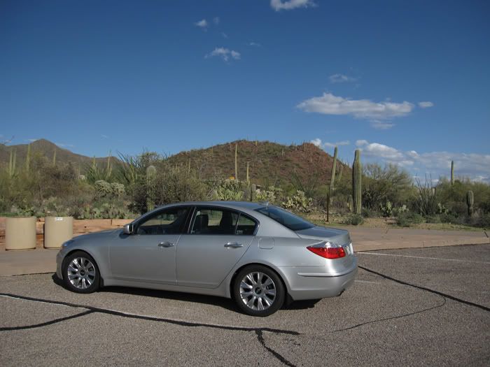
I returned to Speedway Boulevard, then headed further west. Speedway Boulevard becomes Gates Pass Road, and goes over the Tucson Mountains into the wide expanse of Avra Valley. Avra Valley is home to Old Tucson Studios, Arizona-Sonora Desert Museum (excellent zoo/botanical garden I had visited twice before), and the western portion of Saguaro National Park. Both Gates Pass and Avra Valley are lined with saguaros and other desert plants - it's quite a sight.
Now I have arrived at the park visitor center, to pay admissions and get acquainted.
While the park also has an eastern portion on the slopes of the Rincons, I won't have time to get out there this time.
I am now driving the dirt loop inside the park, with great views of the surrounding landscape.
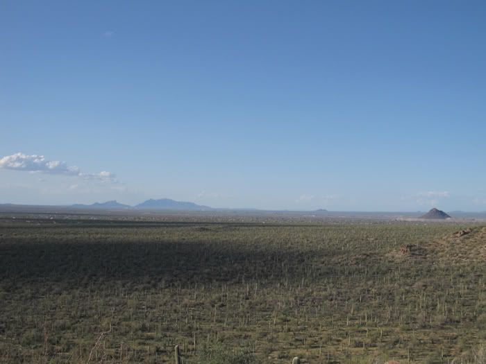
At the end of one pedestrian trail, I am looking due north. Those two peaks on the left are Picacho Peak, a major landmark for travelers between California and Texas. In fact, Tucson joined the US as part of the Gadsden Purchase in 1853, because the logical travel path between California and Texas, both new US territories as of 1848, came through here, still part of Mexico then. Railroads, and now I-10, go through Picacho Peak.
I continue to see saguaros as far as my eyes can see. Quite a sight! It's also notable that the scenery is much greener than I used to remember; that is due to record levels of precipitation during the winter. In fact, I would meet some heavy downpours on my drive back to California the next day.
Although this photo looks as if there is no human presence out there, there is actually quite a bit. There are some random shacks that belong to the town of Marana, which is now the northern bedroom community for Tucson. In addition, Pinal Airpark, a huge airfield that takes in and dismantles old airliners, is somewhere out there too - the dry desert climate is conducive to aircraft storage, the same reason why military aircraft are stored and dismantled in Tucson.
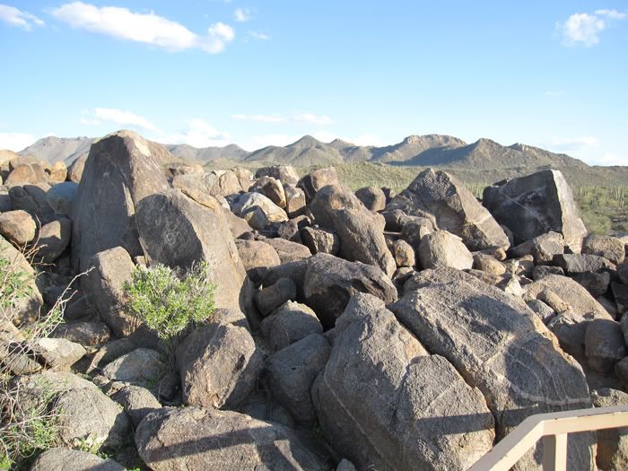
Here are some petroglyphs, left behind by the Hohokam, or the "Forgotten People." Not much is known about them; they are as mysterious as the Anasazi, who also left petroglyphs and disappeared.
The Tohono O'odham (Desert People) tribe, whose reservation takes up much of Avra Valley, are probable descendants of the Hohokam.
I wound down for the evening, by heading up Oracle Road from downtown. Oracle and Miracle Mile is only a block away from my apartment in those poverty days - and a very familiar area for me still. I drove up further on Oracle, until hitting Tucson Mall at the northwestern edge of the city, where I had dinner and did some window shopping. I wrapped up by stopping at the nearby Borders Bookstore, which was my "home" big box chain bookstore during my Tucson days, and reading some magazines and current event books.
All in all, this trip was a good reminder of all the things I used to like, and hate, about Tucson. And I am so glad to be out of that economic dead-end.